Terrain following is an important feature for drone operations conducted in areas with changing elevation. It allows the drone to automatically adjust its altitude to maintain a consistent height above the ground throughout the flight. This not only helps ensure accurate data collection and a consistent ground sampling distance, but also enhances flight safety by reducing the risk of collisions with uneven terrain or obstacles.
You can follow these steps to enable terrain following in your mission on DJI Pilot 2:
1. Power on your RC and open DJI Pilot 2
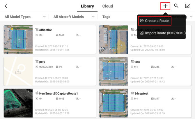
2. Click on Flight Route
3. Click on the + icon, then Create a Route
4. Click on Area Route
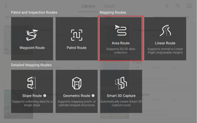
Note: Terrain following is also supported on Linear Routes
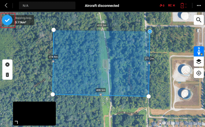
5. Outline your area of interest and click on the checkmark in the top left of the screen
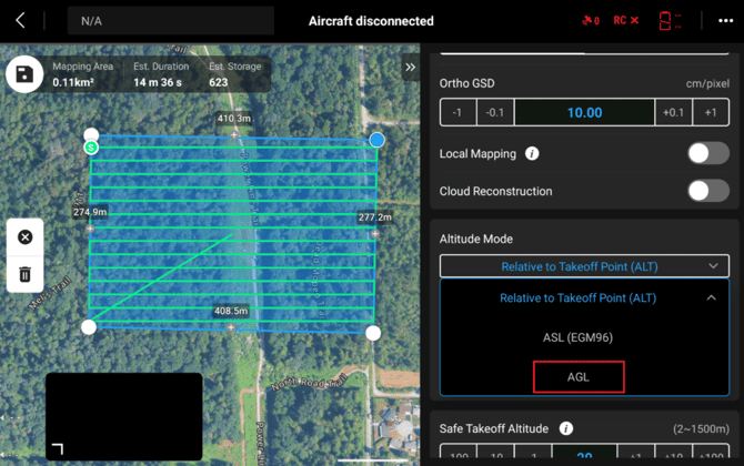
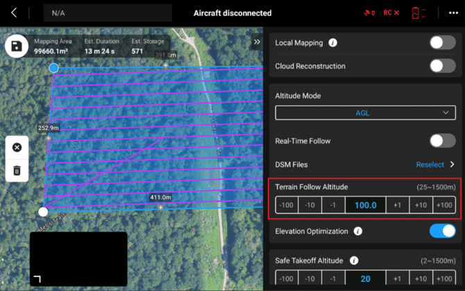
6. Set your Altitude mode to AGL (above ground level)
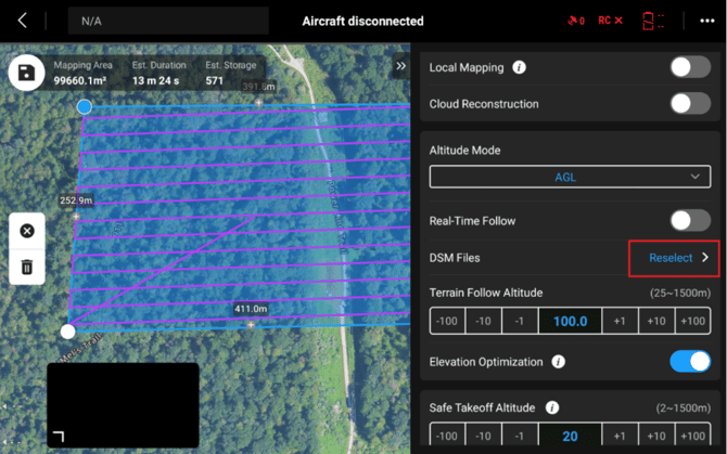
7. Select Terrain Follow Mode
a. DSM FileThis option uses a Digital Surface Model (DSM) to provide elevation data for your mission. You can either:
- Upload your own DSM file, or
- Download one directly to the controller from the internet for quick setup.
If you use an online DSM, always verify its accuracy before flying. Terrain conditions can change over time due to construction, vegetation growth, or erosion, which may cause discrepancies between the DSM and the actual ground surface.
To use the DSM File option, click on Select/Reselect
Select your local DSM file or Download one from the internet
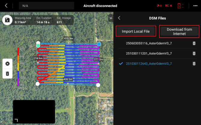
Then you should see the lines change colour based on the elevation. At this point you can check the accuracy of the DSM to ensure it lines up with the site.
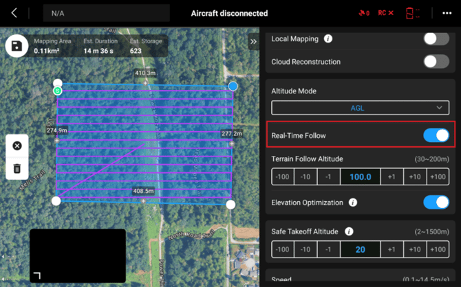
b. Real-Time Follow
Available on M3E Series, M4E Series, and M400 drones, this mode uses the drone’s onboard sensors to actively measure ground distance and automatically adjust altitude during flight.
Important: Real-Time Follow cannot be used normally in rainy, snowy, foggy conditions, or low light environments. More Details
To use this mode, simply enable Real-Time Follow in the mission settings. No DSM file is required.
8. Set your Terrain Follow Altitude
This is the altitude which your drone will maintain above ground level
You have now successfully enabled terrain following on your mission!